
Standing at the visitor center with a park map in hand, most people have no idea which of the dozens of red rock canyon hiking trails actually fits their time, fitness level, or the heat that day. Pick wrong and you either end up on a crowded gravel loop with no payoff or stranded on a slickrock scramble with kids and not enough water.
This list solves that problem. Below you’ll find nine trails covering the full range of Red Rock Canyon, from easy half-mile walks to waterfalls and petroglyphs, to strenuous full-day routes up sandstone peaks. Each entry includes distance, difficulty, elevation gain, and the specific highlight that makes it worth lacing up your boots, whether that’s a slot canyon, a hidden pool, or a summit view over the entire Las Vegas valley.
We’ve guided thousands of visitors through this canyon over the years, and the same question comes up every time: which trail actually matches what you want out of the day. If you’d rather skip the planning and logistics entirely, our guided Red Rock tours pair you with a local expert who knows exactly when trails get crowded, where the shade is, and which viewpoints most hikers miss. Either way, here’s exactly where to start.
1. Lost Creek Trail and Petroglyph Wall
If you only have an hour or two in the canyon, this is the trail we send people to first. Lost Creek Trail sits near the start of the Scenic Drive and packs ancient rock art, a seasonal waterfall, and a shaded box canyon into a walk short enough for almost anyone to finish before lunch.
Distance, difficulty, and elevation gain
This is one of the most approachable red rock canyon hiking trails in the entire park, which is exactly why it tops this list. The full loop runs about 2.4 miles round trip with only around 300 feet of elevation gain, most of it gradual.
| Detail | Info |
|---|---|
| Distance | 2.4 miles round trip |
| Difficulty | Easy |
| Elevation gain | ~300 feet |
| Estimated time | 1 to 1.5 hours |
Kids and first-time hikers handle this route without much complaint, and you won’t need trekking poles or technical footwear to enjoy it.
Trailhead and parking
Parking sits at the Lost Creek Trailhead, roughly the eleventh stop along the one-way Scenic Drive loop. The lot fills up by mid-morning on weekends, so arrive early or plan for a short wait. There’s a vault toilet at the trailhead but no water, so fill your bottles before you leave the visitor center.
Highlights along the trail
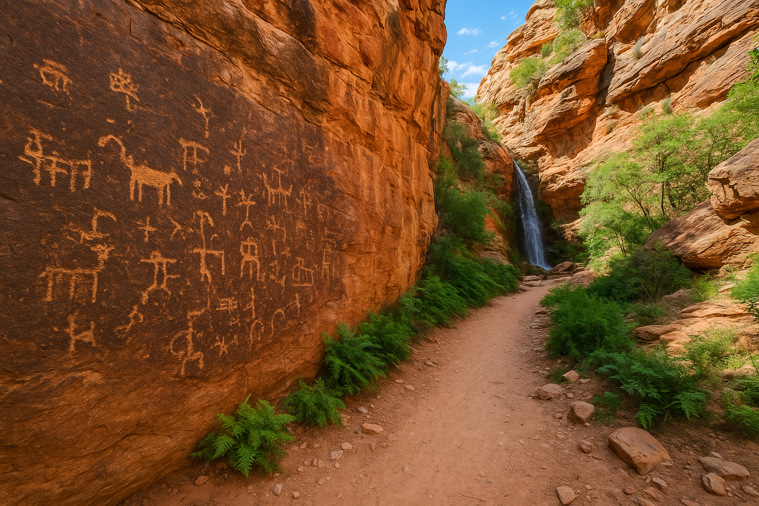
About a third of a mile in, a short spur trail leads to the petroglyph wall, where you can see rock carvings left by the ancestors of the Southern Paiute people centuries ago. Stay on the marked path here; touching or climbing near the panels damages them permanently. Continue past the spur and the canyon narrows into a cool, fern-lined passage that ends at a pour-off, which becomes a genuine seasonal waterfall after winter rains or summer monsoons.
A one-hour walk here delivers petroglyphs, a waterfall, and shade, more payoff per mile than almost any other trail in the park.
Best for
Families with young kids, first-time visitors squeezing a hike into a busy Vegas itinerary, and anyone hiking in the middle of the day when the box canyon’s shade offers real relief from the sun. It also works well for hikers recovering from a long night on the Strip who still want to see something memorable without pushing their body too hard.
Tips for a great hike
A few small adjustments make this short trail even better:
- Go early or late to avoid the parking crush and catch better light for photos at the petroglyph wall.
- Check for water at the pour-off after storms; the waterfall only runs during and shortly after rain.
- Bring at least one liter per person even though the hike is short, since there’s zero shade once you leave the box canyon.
- Watch your footing on the slickrock sections near the waterfall, which stay slippery long after rain has stopped.
- Skip climbing on the petroglyph panels, both for preservation and because it’s illegal within the Red Rock Canyon National Conservation Area.
If you’re short on time and want the story behind what you’re seeing, this trail also pairs naturally with a guided outing that covers the history without you needing to research it yourself.
2. Pine Creek Canyon Trail
Pine Creek Canyon Trail trades petroglyphs for ruins and towering rock walls, and it’s the trail we recommend once someone tells us they’ve already done Lost Creek. This moderate route drops you into a wide, boulder-strewn canyon beneath the Rainbow Mountain Wilderness, with the crumbling remains of the old Wilson historic ranch site marking the start.
Distance, difficulty, and elevation gain
Plan on roughly 3 miles round trip if you go to the confluence of the canyon’s two forks, with about 400 feet of elevation gain along the way. It’s steeper and rockier than Lost Creek, which pushes it into moderate territory rather than easy.
| Detail | Info |
|---|---|
| Distance | 3 miles round trip |
| Difficulty | Moderate |
| Elevation gain | ~400 feet |
| Estimated time | 2 to 3 hours |
Experienced hikers who want to keep pushing can scramble further up either fork toward the base of the sandstone cliffs, though that adds significant time and technical difficulty.
Trailhead and parking
Overnight parking sits at the Pine Creek Canyon Trailhead, about the sixth stop on the Scenic Drive. Lot space is generous compared to Lost Creek, so you rarely wait long even midday. There’s no water source at the trailhead, so top off before leaving the visitor center.
Highlights along the trail
The old ranch foundation near the start gives context before the canyon opens into a dramatic amphitheater of red and white sandstone. Ponderosa pines, unusual for this desert elevation, cluster in the shaded creek bed, and the towering walls of the Rainbow Mountain Wilderness rise on either side.
The scenery here rivals anything in the park, and most tourists never make it past Calico Basin to see it.
Best for
Hikers who want more solitude and scenery than the shorter trails offer, without committing to a full-day summit push. It suits anyone comfortable with rocky, uneven footing.
Tips for a great hike
- Wear real hiking shoes, not sandals; the creek bed is loose rock and boulders the whole way.
- Bring 2 liters minimum, since there’s no reliable shade until you’re deep in the canyon.
- Turn back at the confluence unless you have scrambling experience and extra daylight.
3. Calico Tanks Trail
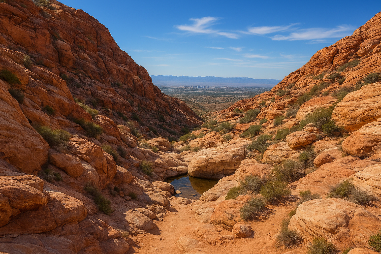
Calico Tanks Trail is the one we point to when someone wants a real workout with a payoff view, but doesn’t have a full day to spend in the canyon. This popular route climbs through a boulder-choked wash to a natural rock basin that holds water for months after a good rain, then rewards you with a wide view over the Las Vegas valley.
Distance, difficulty, and elevation gain
Round trip, you’re looking at about 2.5 miles with 450 feet of elevation gain, most of it packed into the final push over slickrock. It’s a moderate hike by mileage but the last stretch requires some easy scrambling, which surprises hikers expecting an easy stroll.
| Detail | Info |
|---|---|
| Distance | 2.5 miles round trip |
| Difficulty | Moderate |
| Elevation gain | ~450 feet |
| Estimated time | 1.5 to 2.5 hours |
Trailhead and parking
Start at the Sandstone Quarry parking area, roughly the third stop on the Scenic Drive. This lot fills fast, often by 9 a.m. on weekends, since Calico Tanks ranks among the most searched red rock canyon hiking trails on the loop. There’s no water at the trailhead, so bring what you need before you set out.
Highlights along the trail
The trail winds between towering red and white sandstone formations before narrowing into a rocky gully that leads to the tanks themselves, natural depressions in the rock that fill after rain and stay cool in shade. Past the main tank, a short scramble up the slickrock opens onto a panoramic overlook of the Las Vegas Strip and the surrounding valley floor.
Few trails in the park pack a slot-canyon scramble and a Strip-skyline view into one 2.5-mile loop.
Best for
Active travelers who want a moderate challenge and a photo-worthy summit view without a full-day commitment. It also suits groups where fitness levels vary, since the tanks make a satisfying turnaround point.
Tips for a great hike
- Wear grippy shoes for the slickrock scramble near the final overlook.
- Time it right, since the tanks hold water mainly in spring and after summer storms.
- Start before 8 a.m. in warmer months to beat both the heat and the parking rush.
4. Keystone Thrust Trail
Keystone Thrust Trail is the one we recommend to anyone who wants to see the actual geology that shaped this canyon, not just admire it from a distance. This short but steep climb leads to the exposed line where ancient gray limestone sits on top of much younger red sandstone, a rare visible fault line that geologists travel from around the world to study.
Distance, difficulty, and elevation gain
The out-and-back route runs about 2.2 miles round trip with roughly 450 feet of elevation gain, packed mostly into the second half. That climb bumps this into moderate territory among red rock canyon hiking trails, even though the distance looks modest on paper.
| Detail | Info |
|---|---|
| Distance | 2.2 miles round trip |
| Difficulty | Moderate |
| Elevation gain | ~450 feet |
| Estimated time | 1.5 to 2 hours |
Good shoes matter more than stamina here, since loose gravel on the upper switchbacks catches people off guard.
Trailhead and parking
Access starts from the Sandstone Quarry parking area, the same lot used for Calico Tanks, so arrive early to snag a spot. No water source exists along the route, and there’s no shade once you clear the lower wash.
Highlights along the trail
Halfway up, the trail crosses directly onto the thrust fault line itself, where you can put a hand on gray limestone millions of years older than the red sandstone beneath it. Push higher and the switchbacks open onto sweeping views back toward the quarry and the valley floor.
Standing on the fault line, you’re touching two different geologic eras with one hand.
Best for
Geology fans, photographers chasing contrasting rock colors, and hikers who want a short but genuinely steep workout without a full-day commitment.
Tips for a great hike
- Bring trekking poles for the loose gravel on the descent.
- Carry 2 liters of water, since shade disappears past the lower wash.
- Time your visit for morning light, which makes the color contrast between the rock layers far more dramatic.
5. First Creek Canyon Trail
First Creek Canyon Trail is the one we suggest to anyone who wants a genuine desert oasis without needing a timed-entry ticket for the Scenic Drive. Sitting just outside the main entrance station, this trail follows a live creek bed lined with cottonwoods and willows up into the shadow of the Rainbow Mountain Wilderness, making it one of the greener red rock canyon hiking trails in the entire park.
Distance, difficulty, and elevation gain
Most hikers turn around at the seasonal waterfall and pools around 2.5 miles round trip, though the trail continues further into Krippner Canyon for those with more time. Elevation gain stays moderate at roughly 450 feet, spread out enough that it rarely feels punishing.
| Detail | Info |
|---|---|
| Distance | 2.5 miles round trip (to the falls) |
| Difficulty | Easy to moderate |
| Elevation gain | ~450 feet |
| Estimated time | 1.5 to 2.5 hours |
Beyond the falls, the canyon narrows and requires some rock-hopping across the creek, which adds difficulty without adding much distance.
Trailhead and parking
Parking sits along SR-159 at the First Creek Trailhead, before you reach the fee station for the Scenic Drive loop. That location matters: you can hike this trail without a timed entry reservation, which makes it a smart backup when the loop is full. The lot is small and fills quickly on weekends, and there’s no water or restroom facility on site.
Highlights along the trail
Within the first mile, the trail follows an actual flowing creek, a rarity in this desert landscape, past thick stands of cottonwood trees that turn gold in late fall. Higher up, seasonal pools and a modest waterfall sit tucked beneath towering canyon walls.
A live creek shaded by cottonwoods feels like a different ecosystem entirely, ten minutes off the main highway.
Best for
Birdwatchers, hikers avoiding Scenic Drive crowds, and anyone visiting during a busy timed-entry window who still wants a real canyon hike.
Tips for a great hike
- Check the creek crossings after rain; water levels rise fast and rocks get slick.
- Watch for wildlife, since the riparian habitat attracts more birds and the occasional rattlesnake than drier trails.
- Arrive by 8 a.m. on weekends to guarantee a parking spot.
6. White Rock and La Madre Spring Loop
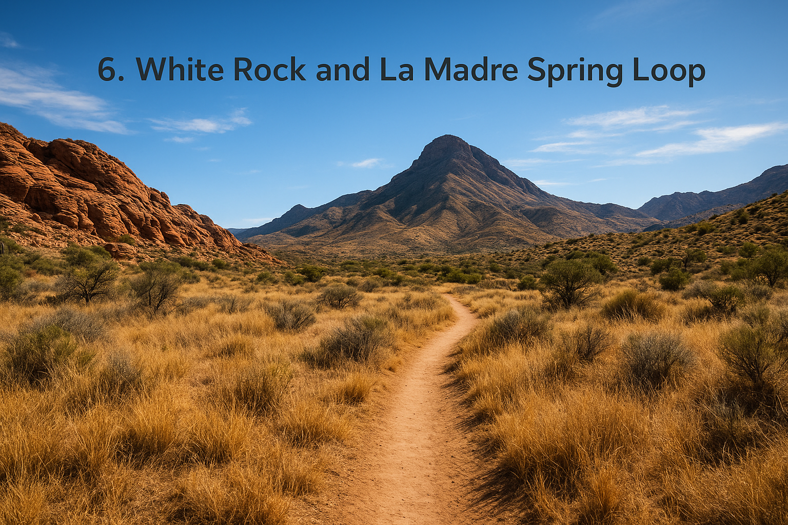
White Rock and La Madre Spring Loop is the trail we recommend once someone tells us they want distance and variety without the crowds clogging Calico Basin. This loop threads through open desert grassland, climbs into a shaded spring-fed pocket, and gives you a full lap around the base of La Madre Mountain, making it one of the longer red rock canyon hiking trails most visitors ever attempt.
Distance, difficulty, and elevation gain
Covering the full loop runs about 6 miles round trip with roughly 1,000 feet of elevation gain spread across rolling terrain rather than one steep push. Expect a full half-day commitment here, since the distance alone separates this route from the shorter walks earlier on this list.
| Detail | Info |
|---|---|
| Distance | 6 miles round trip |
| Difficulty | Moderate |
| Elevation gain | ~1,000 feet |
| Estimated time | 3 to 4 hours |
Fitness matters more than technical skill on this one, since the trail stays wide and well-graded the entire way.
Trailhead and parking
Access starts at the White Rock Trailhead, near the western edge of the Scenic Drive loop. The lot is smaller than Sandstone Quarry’s, so weekday mornings offer the best odds of an easy spot. No water or restroom exists at this trailhead, so plan accordingly before you set out.
Highlights along the trail
Early on, the trail crosses open grassland with sweeping views of La Madre Mountain before dipping into a shaded canyon holding La Madre Spring, one of the few reliable water sources in the entire park for wildlife. Wild burros and bighorn sheep sightings happen often enough here that longtime guides consider this the best trail in the park for spotting them.
Six miles of open desert and a hidden spring make this the closest thing to backcountry solitude inside Red Rock Canyon.
Best for
Fit hikers craving distance, wildlife watchers, and anyone burned out on the crowded short loops near the visitor center.
Tips for a great hike
- Start early, since exposed grassland offers zero shade for the first two miles.
- Bring 3 liters of water given the length and lack of resupply points.
- Watch for wild burros near the spring, and keep a respectful distance.
7. Turtlehead Peak Trail
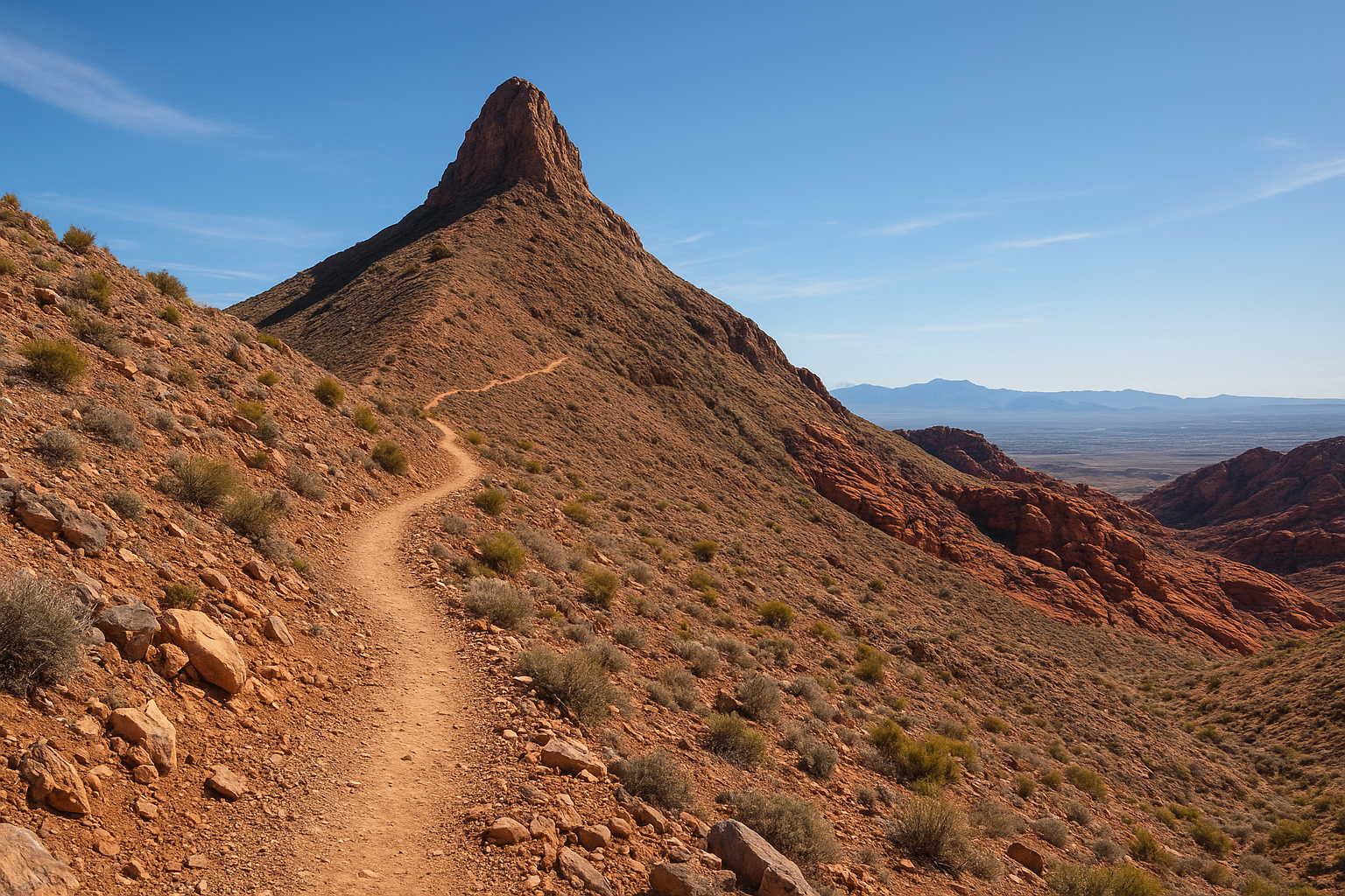
Turtlehead Peak Trail is the one we save for hikers who ask which summit in the park gives the biggest reward for the effort. This strenuous climb switchbacks up loose scree to the top of the most recognizable peak on the Scenic Drive skyline, delivering a 360-degree view that few other red rock canyon hiking trails can match.
Distance, difficulty, and elevation gain
Getting to the summit and back covers roughly 4.6 miles round trip with about 2,000 feet of elevation gain, most of it stacked into the final mile of switchbacks. Loose rock and exposed sun make this one of the harder half-day hikes in the entire conservation area.
| Detail | Info |
|---|---|
| Distance | 4.6 miles round trip |
| Difficulty | Strenuous |
| Elevation gain | ~2,000 feet |
| Estimated time | 3 to 4.5 hours |
Only attempt this route if you’re already comfortable with steep, unmaintained terrain and have a full morning or afternoon to spare.
Trailhead and parking
Start from the Sandstone Quarry parking area, the same busy lot serving Calico Tanks and Keystone Thrust. Arrive right at opening to guarantee a spot, since three popular trails compete for the same small lot. There’s no water or shade anywhere on this route, so fill every bottle before leaving the visitor center.
Highlights along the trail
After a flat approach across the wash, the trail climbs steadily until the switchbacks begin, and that’s where the payoff builds. From the summit, you get a clear view of the entire Las Vegas valley on one side and the red sandstone peaks of the conservation area on the other.
No other summit in the park puts the entire Las Vegas valley and the red rock peaks in the same frame.
Best for
Experienced hikers chasing a true summit, fitness-focused travelers, and anyone who wants bragging rights over the best view in the park.
Tips for a great hike
- Start at sunrise to avoid climbing exposed scree in full afternoon heat.
- Carry at least 3 liters, since there’s zero shade or water source on the entire route.
- Wear ankle-supportive boots, since the scree near the summit shifts underfoot.
8. Ice Box Canyon Trail
Ice Box Canyon Trail earns its name honestly. Cool air pools inside this shaded, boulder-choked canyon even in July, which makes it one of the best red rock canyon hiking trails for hikers who refuse to give up mid-summer hiking entirely. The trail follows a rocky wash beneath towering cliffs until boulders force most people to turn around short of the seasonal waterfall at the canyon’s head.
Distance, difficulty, and elevation gain
Expect roughly 2.6 miles round trip with about 580 feet of elevation gain, most of it uneven rather than steep. Rock-hopping over loose boulders makes this feel harder than the elevation number suggests.
| Detail | Info |
|---|---|
| Distance | 2.6 miles round trip |
| Difficulty | Moderate |
| Elevation gain | ~580 feet |
| Estimated time | 2 to 3 hours |
Good ankle support matters here more than raw fitness, since the footing never stays flat for long.
Trailhead and parking
Parking sits at the Ice Box Canyon Trailhead, roughly the eighth stop along the Scenic Drive. The small lot fills up on weekends by mid-morning, so plan an early start if you want a spot without circling. No water or restroom exists here, so top off before you leave the visitor center.
Highlights along the trail
Deep shade and cooler temperatures set in almost immediately after you cross the wash, a welcome change from the exposed trails elsewhere on this list. Sheer canyon walls close in overhead, and after a good rain, a seasonal waterfall drops into a pool near the canyon’s dead end.
When every other trail in the park bakes in full sun, Ice Box Canyon stays noticeably cooler from the first quarter mile.
Best for
Hikers visiting during summer heat, anyone craving shade over views, and photographers chasing dramatic light filtering between narrow canyon walls.
Tips for a great hike
- Wear shoes with real traction, since boulder-hopping continues for most of the route.
- Check recent trip reports for water levels, since the waterfall only flows after rain.
- Bring layers, since the shaded canyon runs noticeably cooler than the trailhead parking lot.
9. Kraft Mountain Loop Trail
Kraft Mountain Loop Trail is the pick for anyone staying in Calico Basin who wants a real climb without driving into the main conservation area at all. This loop circles a striking sandstone dome, threading through a natural rock arch and a set of famous potholes known as the Bacon and Eggs formation before dropping back to the trailhead.
Distance, difficulty, and elevation gain
Expect roughly 4 miles round trip with about 800 feet of elevation gain, most of it concentrated in a steep push up the mountain’s north face. Loose rock and exposed slickrock make this one of the trickier moderate red rock canyon hiking trails on this list, even though the mileage sounds manageable.
| Detail | Info |
|---|---|
| Distance | 4 miles round trip |
| Difficulty | Moderate to strenuous |
| Elevation gain | ~800 feet |
| Estimated time | 2.5 to 3.5 hours |
A short detour to the summit adds distance and a scramble, so skip it if you’re short on time or daylight.
Trailhead and parking
Access starts at the Calico Basin parking area, outside the main Scenic Drive entrance, which means no timed-entry reservation required. The lot fills early on weekends since rock climbers share it with hikers. No water or restroom sits at the trailhead itself.
Highlights along the trail
Just past the halfway point, the trail passes beneath a natural sandstone arch before reaching the Bacon and Eggs, a cluster of rounded potholes that hold water after storms. Views back toward Calico Basin and the Las Vegas valley open up steadily as you climb.
A natural arch and a summit view within four miles, all without a timed-entry pass, is hard to beat this close to the city.
Best for
Rock climbers and boulderers looking for a warm-up hike, photographers chasing the arch and potholes, and hikers who want a workout without entering the main fee area.
Tips for a great hike
- Arrive before 8 a.m. since climbers and hikers compete for the same small lot.
- Bring 2 liters of water, as shade disappears once you clear the lower boulders.
- Skip the summit scramble in wet or windy conditions, since the slickrock gets dangerous fast.
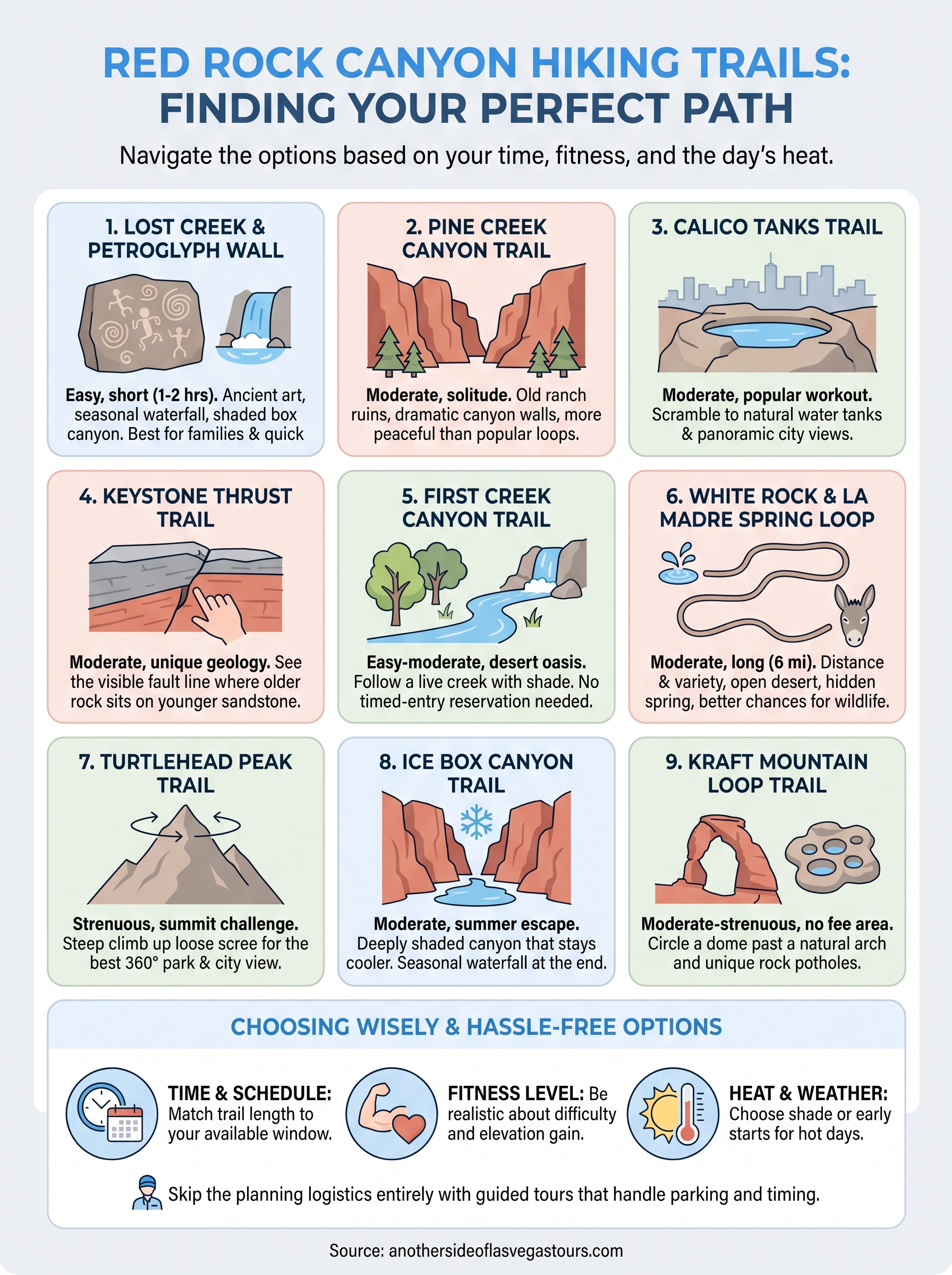
Choosing the right trail for your visit
Nine trails, nine different reasons to lace up your boots. Short on time? Lost Creek delivers petroglyphs and a waterfall in an hour. Chasing a summit view? Turtlehead Peak or Kraft Mountain will earn it the hard way. Hiking in July? Ice Box Canyon stays cool when everything else bakes. Matching the trail to your fitness level, schedule, and the day’s heat matters more than picking the "best" one on paper, since the right easy hike beats a miserable strenuous one every time.
Getting the logistics right, parking, timing, water, still trips people up even with a solid list in hand. If you’d rather hand that off entirely, our guides know exactly which trailhead lot fills first and which viewpoint gets skipped by the crowds. Book a private Red Rock Canyon tour and spend your day hiking instead of planning it.