
You’ve got a day, maybe two, in Las Vegas, and you keep hearing that Red Rock Canyon is worth the drive out of the city. It is, but the best trails at Red Rock Canyon aren’t always the ones showing up first in a random Google search or a rushed park map. Some routes look short on paper but turn brutal in the desert heat by 10am, and others get skipped entirely even though they deliver the best views in the whole conservation area.
This guide skips the guesswork. We’re breaking down nine trails that actually earn their reputation, covering distance, difficulty, and the payoff view for each one, so you can match a hike to the time you have and the shape you’re in. Whether you want a quick scenic loop before heading back to the Strip or a longer scramble through sandstone canyons, you’ll know exactly what you’re signing up for before you park the car.
We’ve spent years guiding visitors through this exact landscape, so this list reflects what actually works for real travel schedules, not just what looks good on a brochure. Keep reading for the nine trails worth your time, plus what to know before you lace up your boots.
1. Calico Tanks Trail
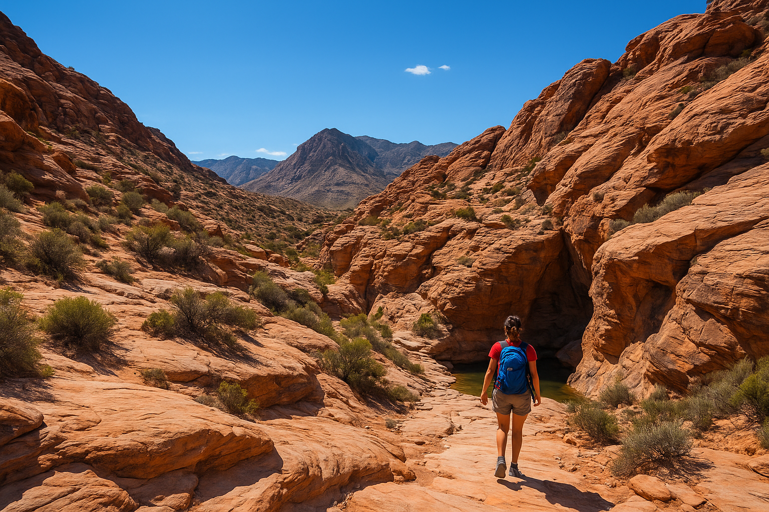
Calico Tanks Trail sits at the top of nearly every recommendation list for a reason. It’s the single best introduction to Red Rock Canyon for visitors who want a real payoff without committing an entire day, and it starts right from the popular Sandstone Quarry parking area off the scenic loop drive.
Difficulty and distance
This is a moderate hike covering roughly 2.5 miles round trip with about 450 feet of elevation gain. Most hikers finish it in two to two and a half hours, including time to sit at the top and take photos. The trail isn’t technical, but the last stretch involves scrambling over smooth sandstone and a short section where you’ll use your hands, so leave the flip-flops at the hotel.
| Metric | Detail |
|---|---|
| Distance | 2.5 miles round trip |
| Elevation gain | ~450 feet |
| Difficulty | Moderate |
| Average time | 2-2.5 hours |
| Trailhead | Sandstone Quarry parking area |
What to expect on the trail
Expect a trail that changes character three times. It opens through a wash lined with desert scrub, climbs past the old quarry walls where you can still see chisel marks from decades of sandstone mining, then narrows into a rocky canyon before the final scramble to a natural tank, a seasonal water pool carved into the rock. The summit view opens onto the Las Vegas Strip in the distance, framed by red sandstone in every direction, and it’s the kind of payoff that makes the climb feel short in hindsight.
The final scramble to the tanks is short, but it’s what turns a good hike into an unforgettable one.
Best for
Calico Tanks suits first-time visitors who want one standout hike without dedicating a full day to the park. It also works well for families with older kids and moderately fit travelers who can handle some rock scrambling but don’t want technical climbing gear or ropes.
Tips for hiking it
- Start before 8am in summer; there’s almost no shade on this trail
- Carry at least one liter of water per person, more in warmer months
- Wear shoes with real traction for the sandstone scramble near the top
- Skip it after heavy rain, since the tank fills and the rock gets slick
- Combine it with a stop at the quarry ruins on your way back down
2. Lost Creek Trail
Lost Creek Trail is the trail you pick when you want desert scenery without the sweat. It’s tucked near Willow Spring, close to Ice Box Canyon, and it packs waterfalls, rock art, and shaded canyon walls into a hike short enough to squeeze in before lunch.
Difficulty and distance
This one is easy, running about 0.75 miles round trip with barely any elevation change. Plan on 30 to 45 minutes, less if you don’t linger at the seasonal waterfall near the trail’s end. It’s flat enough for sneakers and manageable for most fitness levels, which makes it one of the more forgiving options on this list.
| Metric | Detail |
|---|---|
| Distance | 0.75 miles round trip |
| Elevation gain | Minimal |
| Difficulty | Easy |
| Average time | 30-45 minutes |
| Trailhead | Willow Spring parking area |
What to expect on the trail
Walking the loop takes you through a wash shaded by scrub oak and past a small seasonal waterfall that only runs after rain or snowmelt, so don’t count on it in the dry summer months. Petroglyphs sit on rock faces near the start if you know where to look, and the canyon walls close in enough to drop the temperature noticeably compared to the open desert.
Lost Creek proves you don’t need mileage to get a real taste of Red Rock Canyon.
Best for
Lost Creek works best for families with young kids, visitors short on time between other stops, or anyone recovering from a longer hike the day before who still wants to get outside.
Tips for hiking it
- Visit after a recent rain for the best shot at seeing water
- Bring kids here first to build confidence before longer trails
- Look for petroglyphs on rock walls near the trailhead
- Pair it with Ice Box Canyon since both trailheads sit close together
3. Pine Creek Canyon Trail
Pine Creek Canyon Trail takes you into one of the most dramatic canyons in the whole conservation area, with towering rock walls and the ruins of an old homestead tucked along the way. It starts from a quieter trailhead south of the Sandstone Quarry, so you’ll share the path with fewer crowds than the busier hikes further north on the loop.
Difficulty and distance
Expect a moderate hike of about 3.5 miles round trip with roughly 500 feet of elevation gain. Budget two to three hours depending on how much time you spend exploring side paths near the canyon mouth. The trail stays mostly on flat wash bottom until the final approach, where the terrain gets rockier and less defined.
| Metric | Detail |
|---|---|
| Distance | 3.5 miles round trip |
| Elevation gain | ~500 feet |
| Difficulty | Moderate |
| Average time | 2-3 hours |
| Trailhead | Pine Creek Canyon parking area |
What to expect on the trail
Setting off across an open desert flat, you’ll pass the crumbling foundation of the old Wilson homestead before the trail funnels into a narrowing canyon lined with ponderosa pines, an unusual sight this close to the desert floor. The canyon splits into two forks near its end, both leading toward sheer rock faces popular with rock climbers.
Pine Creek Canyon delivers the closest thing to a mountain forest you’ll find inside Red Rock’s desert terrain.
Best for
This trail suits experienced hikers who want solitude and scenery without the technical scrambling required elsewhere on this list, plus photographers chasing the contrast between pine trees and red rock.
Tips for hiking it
- Watch for climbers on the canyon walls near the trail’s end
- Wear sturdy shoes since the wash bottom gets uneven and rocky
- Bring extra water; there’s little shade past the homestead ruins
- Visit early morning for the best light on the canyon walls
4. Calico Hills Trail
Calico Hills Trail gives you the sandstone playground everyone photographs from the scenic loop road, minus the summit scramble of Calico Tanks. It sits right across from the same Sandstone Quarry pullout, making it easy to combine both hikes into one stop if you’ve got the morning free.
Difficulty and distance
Distance here is flexible since the trail is really a network of connected paths across the rock formations, but a typical loop runs about 2 miles round trip with 300 feet of elevation gain. Most visitors treat it as easy to moderate, depending on how far into the formations they wander. Give yourself an hour and a half, more if you like exploring off the main path.
| Metric | Detail |
|---|---|
| Distance | ~2 miles round trip |
| Elevation gain | ~300 feet |
| Difficulty | Easy to moderate |
| Average time | 1-1.5 hours |
| Trailhead | Sandstone Quarry parking area |
What to expect on the trail
Hiking through Calico Hills means winding across slickrock and sandy washes with red and white sandstone domes rising on every side. There’s no single defined summit, so you’re free to pick your own route between formations, and the views back toward the Strip open up the higher you climb.
Calico Hills rewards curiosity more than endurance, since every direction offers a different angle on the rock.
Best for
Geologists at heart, casual photographers, and anyone who wants to scramble on rock without following a strict trail will enjoy this one most.
Tips for hiking it
- Note landmarks as you go since paths aren’t always marked
- Bring a map or offline GPS app to avoid backtracking
- Wear grippy shoes for the slickrock sections
- Visit midweek for fewer crowds near the popular formations
5. Keystone Thrust Trail
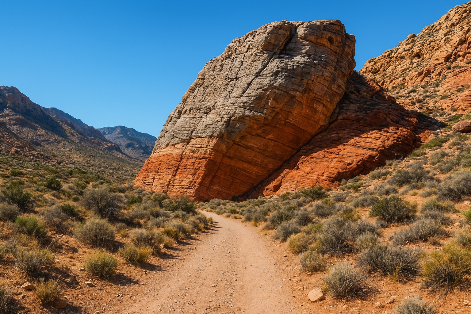
Keystone Thrust Trail is the one geology nerds ask about by name, and it deserves the reputation. It traces the actual fault line where older rock got pushed up and over younger rock millions of years ago, and you can see the color change in the stone as you walk it, right from the same Sandstone Quarry area that anchors several trails on this list.
Difficulty and distance
This is a moderate hike, roughly 2.5 miles round trip with about 400 feet of elevation gain. Plan on ninety minutes to two hours, depending on how long you linger at the thrust line itself. The path is mostly dirt and gravel with a few rocky patches, nothing that demands technical scrambling like Calico Tanks does further along the same trailhead cluster.
| Metric | Detail |
|---|---|
| Distance | 2.5 miles round trip |
| Elevation gain | ~400 feet |
| Difficulty | Moderate |
| Average time | 1.5-2 hours |
| Trailhead | Sandstone Quarry parking area |
What to expect on the trail
Walking this trail means climbing gradually through open desert before reaching the visible thrust fault, a dramatic boundary where gray limestone sits stacked on top of younger red sandstone. Interpretive signage explains what you’re looking at, which makes this one of the few hikes in the park where the scenery doubles as a geology lesson.
Keystone Thrust turns 500 million years of geologic history into something you can touch with your own hands.
Best for
This trail suits curious travelers, science teachers, and anyone who wants a moderate workout paired with genuine educational payoff rather than just scenery.
Tips for hiking it
- Read trailhead signage before starting for context on the fault line
- Bring a camera with wide angle capability for the rock layering
- Combine with Calico Tanks since both share a trailhead
- Hike in cooler morning hours, as shade is limited throughout
6. White Rock Mountain Loop Trail
White Rock Mountain Loop Trail is the longest hike on this list, and it rewards hikers who want a full day outdoors without leaving the main scenic loop drive. It circles White Rock Mountain itself, connecting several smaller paths into one continuous loop that shows off nearly every landscape type found in the conservation area.
Difficulty and distance
Covering about 6.2 miles round trip with roughly 1,000 feet of elevation gain, this trail sits firmly in moderate to strenuous territory. Budget three to four hours, more if you’re not used to desert distance hiking. The path is well-defined for most of its length, though a few rocky stretches near the northern side slow your pace.
| Metric | Detail |
|---|---|
| Distance | 6.2 miles round trip |
| Elevation gain | ~1,000 feet |
| Difficulty | Moderate to strenuous |
| Average time | 3-4 hours |
| Trailhead | Willow Spring or White Rock/Willow Spring loop parking |
What to expect on the trail
Circling the base of the mountain takes you through open desert flats, past Joshua trees, and into shaded canyon sections where the temperature drops several degrees. The eastern half offers wide views of the Rainbow Mountain Wilderness, while the western stretch runs closer to the road, giving you a bailout option if you’re running low on water or daylight.
This loop works as a full sampler of Red Rock Canyon’s terrain in a single outing.
Best for
Seasoned hikers training for longer trips, or anyone with a full afternoon free, will get the most out of this one.
Tips for hiking it
- Start early since the full loop takes real time to finish
- Carry at least two liters of water per person
- Bring a trail map, since junctions with shorter paths can confuse first-timers
- Wear broken-in boots given the total mileage involved
7. Ice Box Canyon Trail
Ice Box Canyon Trail earns its name honestly. Shaded walls trap cool air even on warm afternoons, making this one of the few hikes at Red Rock Canyon where you might actually want a light jacket in the shoulder seasons. It shares a trailhead area with Lost Creek near Willow Spring, so you can knock out both in one stop if you’re working with a tight schedule.
Difficulty and distance
This is a moderate hike, running about 2.6 miles round trip with roughly 580 feet of elevation gain. Most hikers need two to two and a half hours, and the boulder scrambling near the canyon’s end slows things down more than the mileage suggests. The trail surface shifts from packed dirt to loose rock the deeper you go.
| Metric | Detail |
|---|---|
| Distance | 2.6 miles round trip |
| Elevation gain | ~580 feet |
| Difficulty | Moderate |
| Average time | 2-2.5 hours |
| Trailhead | Willow Spring parking area |
What to expect on the trail
Walking into the canyon means trading open desert for tall sandstone walls that box you in on both sides, hence the name. A seasonal waterfall appears at the canyon’s terminus after rain or snowmelt, dropping over dark rock stained by centuries of runoff. Boulder hopping picks up in the final third, and hikers without recent rain to guide them should expect a dry but still scenic dead end.
Ice Box Canyon proves the best shade in the park sometimes comes with the best scenery attached.
Best for
This trail suits hikers escaping summer heat and anyone who prefers dramatic rock walls over wide desert views.
Tips for hiking it
- Check recent weather for waterfall potential before you go
- Wear shoes built for boulder scrambling near the end
- Bring layers, since the canyon stays noticeably cooler
- Pair it with Lost Creek Trail given the shared trailhead
8. Turtlehead Peak Trail
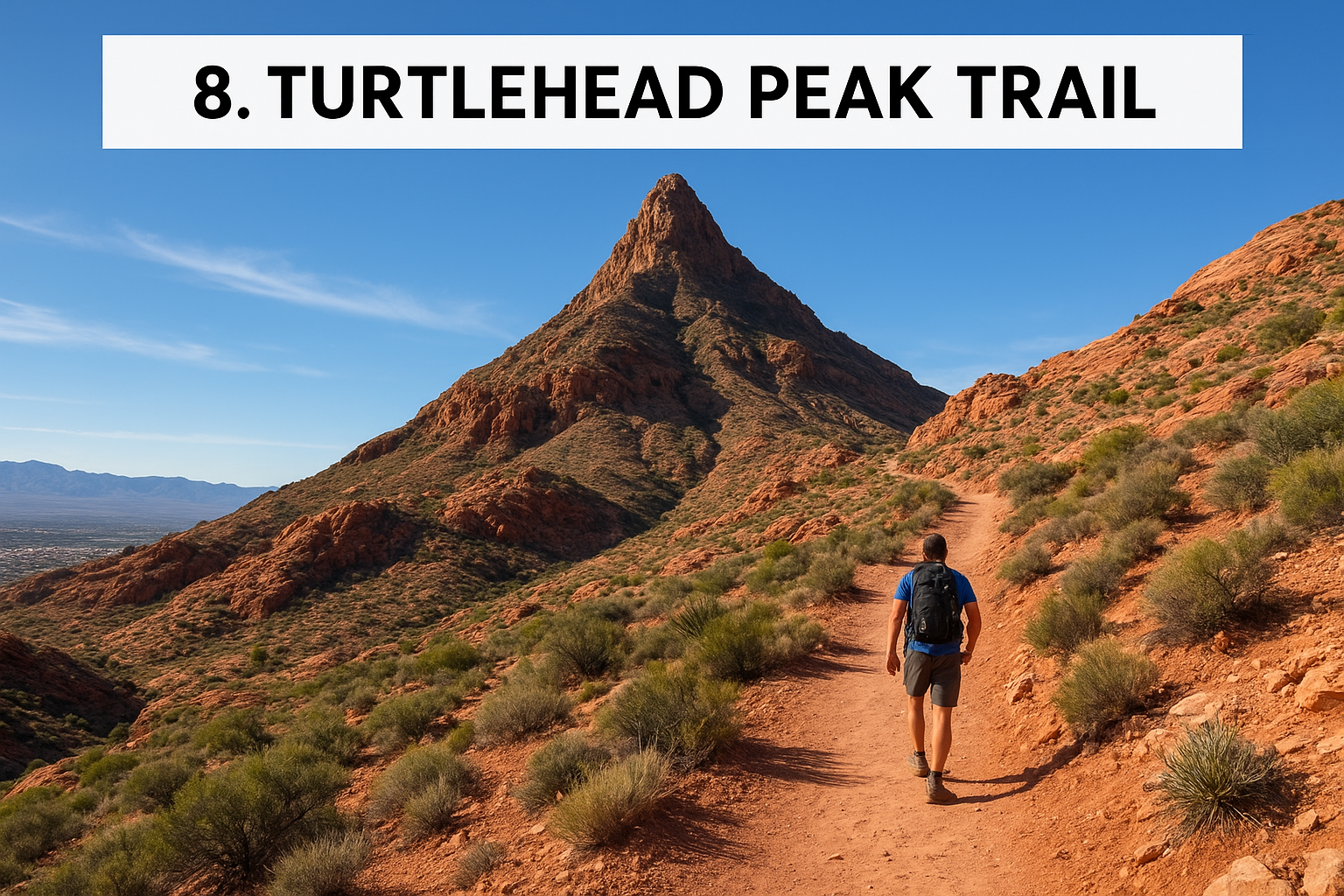
Turtlehead Peak Trail is the toughest climb on this list, and it’s the one to pick if you want bragging rights along with the view. It starts from the Sandstone Quarry area, the same trailhead cluster serving Calico Tanks and Keystone Thrust, but it heads a completely different direction, straight up.
Difficulty and distance
This is a strenuous hike, about 4.6 miles round trip with a punishing 2,000 feet of elevation gain packed into that short distance. Give yourself three to four hours, and expect your legs to feel it the next day. There’s no scrambling requiring hands, but the sustained steep grade makes this harder than anything else in the park’s popular trail list.
| Metric | Detail |
|---|---|
| Distance | 4.6 miles round trip |
| Elevation gain | ~2,000 feet |
| Difficulty | Strenuous |
| Average time | 3-4 hours |
| Trailhead | Sandstone Quarry parking area |
What to expect on the trail
Climbing toward the summit takes you through Calico Hills terrain first, then onto a steep, switchbacking dirt path with almost no shade for the entire ascent. The summit views stretch across the whole Las Vegas valley on one side and deep into Red Rock’s sandstone peaks on the other, a payoff most hikers agree beats every other overlook in the conservation area.
Turtlehead Peak asks for real effort, but it hands back the best view in the entire park.
Best for
This trail suits fit, experienced hikers chasing a genuine summit and a workout, not a casual walk. Skip it if you’re not comfortable with sustained elevation gain in full sun.
Tips for hiking it
- Start at sunrise; there’s zero shade and summer heat turns dangerous fast
- Carry at least two liters of water per person
- Wear supportive boots for the loose gravel switchbacks
- Check the forecast, since wind picks up hard near the summit
9. Kraft Mountain Loop Trail
Kraft Mountain Loop Trail sits outside the main scenic loop drive, tucked into the Calico Basin area near the free parking lot off Calico Basin Road. It’s the trail locals hike when they want a good workout close to town without paying the conservation area’s entrance fee, and it delivers some of the best views of the Calico formations from angles most tourists never see.
Difficulty and distance
This is a moderate hike, running about 3 miles round trip with roughly 800 feet of elevation gain. Most hikers finish in two to two and a half hours, though the loop’s steep middle section slows people down more than the mileage suggests. Footing gets loose on the descent, so trekking poles help if your knees complain on downhills.
| Metric | Detail |
|---|---|
| Distance | 3 miles round trip |
| Elevation gain | ~800 feet |
| Difficulty | Moderate |
| Average time | 2-2.5 hours |
| Trailhead | Calico Basin parking area |
What to expect on the trail
Climbing out of Calico Basin puts you on a ridge with sweeping views back toward the Las Vegas valley within the first mile. The trail loops around Kraft Mountain itself, passing sandstone slabs popular with rock climbers before dropping back down through a wash lined with desert willow.
Kraft Mountain gives you Red Rock’s best views without ever entering the park’s main gate.
Best for
This trail suits budget-conscious hikers, early risers looking to beat park entrance lines, and rock climbing spectators who enjoy watching from a distance.
Tips for hiking it
- Arrive early since the free lot fills fast on weekends
- Wear shoes with ankle support for the loose rock sections
- Bring water, since shade disappears after the first half mile
- Watch your footing on the steep descent back to the basin
Choosing the right trail for your visit
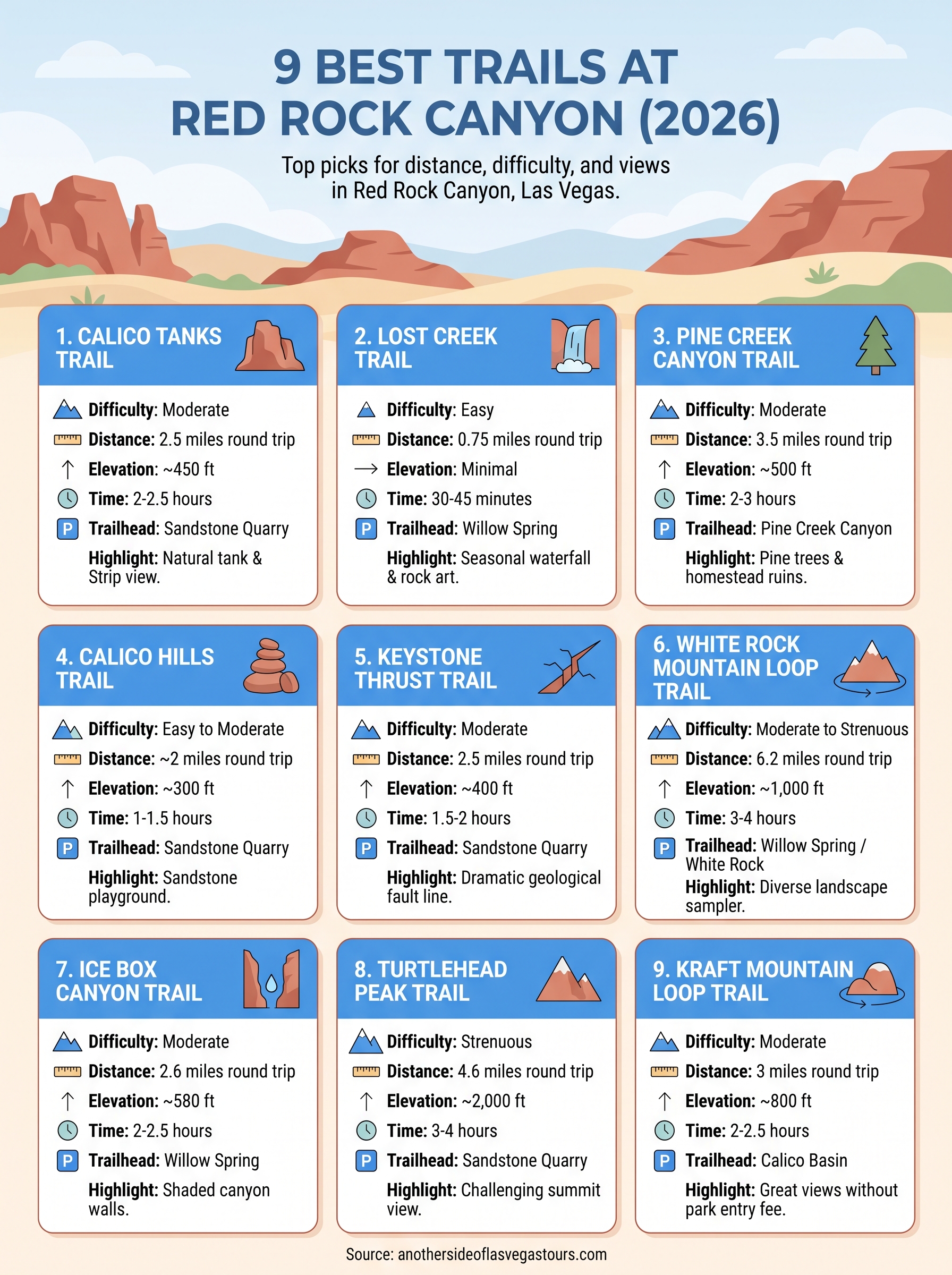
Nine trails, one park, and no shortage of ways to get it wrong if you pick based on a photo instead of your actual fitness level and schedule. Start with Calico Tanks or Lost Creek if this is your first visit and time is tight. Save Turtlehead Peak and White Rock Mountain Loop for mornings when you’ve got real daylight and water to spare. Match the hike to the hours you have, not the other way around, and you’ll avoid the classic mistake of turning around halfway up a switchback because you underestimated the heat.
Getting yourself to the right trailhead, at the right time, with the right context about what you’re looking at, is exactly where a guide earns their keep. If you’d rather skip the planning and let someone else handle the driving, the water, and the storytelling, book a private tour of Red Rock Canyon and hit the trail with an expert instead of a printed map.