
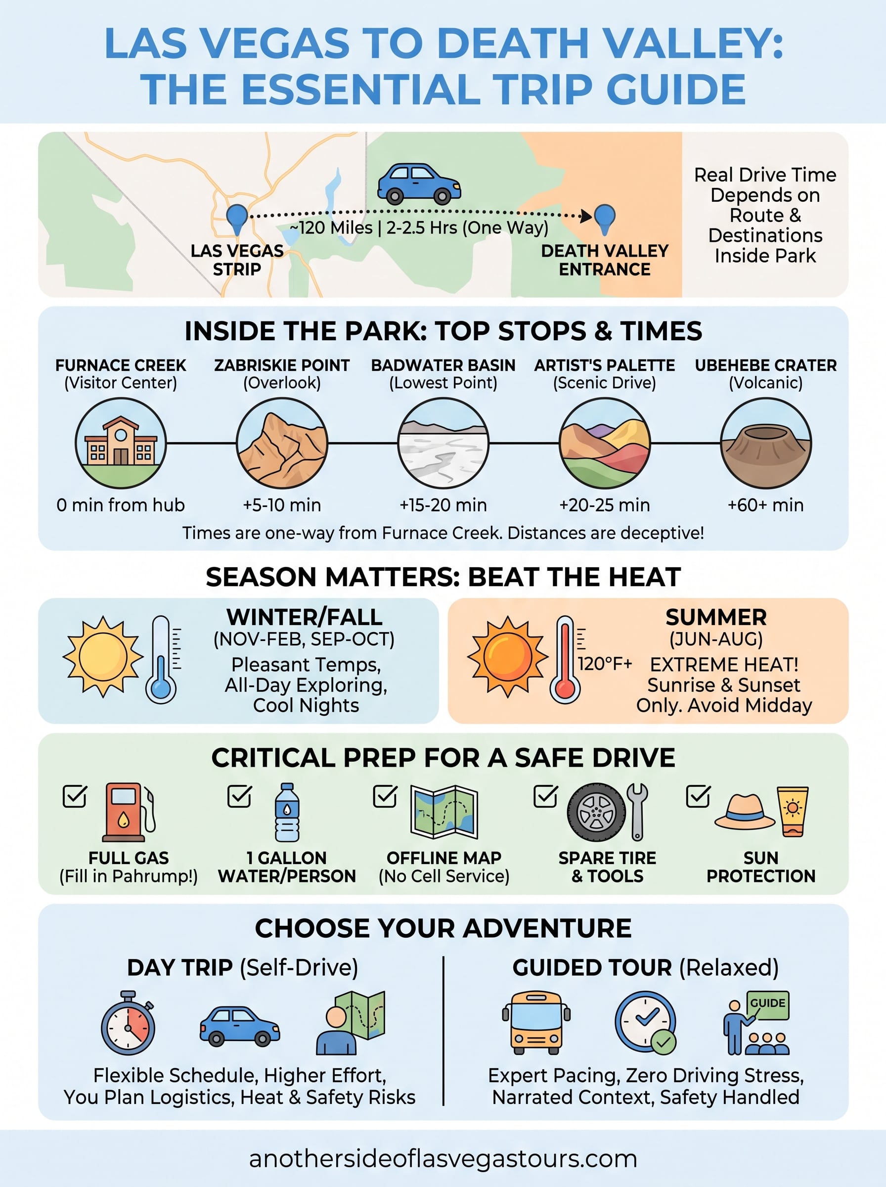
If you’re planning a trip out to the lowest, hottest spot in North America, the first question is simple: how far is Death Valley from Las Vegas? The short answer is about 120 miles to the closest entrance, but the real answer depends on which part of the park you want to see and how much time you actually have. That gap between "it’s close" and "it’s worth doing right" trips up a lot of visitors.
Here’s what you need to know upfront: the drive from the Strip to Death Valley runs roughly two to two and a half hours one way, depending on your route and where inside the park you’re headed. Furnace Creek, the main hub with the visitor center and lowest elevation points, sits at a different distance than Zabriskie Point or the Badwater Basin overlooks, so your exact time in the car shifts based on your itinerary.
In this guide, we’ll break down the mileage from Las Vegas to every major Death Valley entry point, compare the fastest route against the more scenic one, and cover what a realistic day trip looks like once you factor in heat, gas stops, and time at each viewpoint. We’ll also flag when it makes more sense to let someone else handle the driving and narration.
Why the distance matters for planning your trip
Getting the mileage right isn’t just trivia. It changes whether you plan a rushed day trip, an overnight stay, or skip the drive altogether and book a guided outing instead. The distance between Las Vegas and Death Valley looks small on a map, maybe 120 to 140 miles depending on your entry point, but that number doesn’t account for the two-lane desert roads, the lack of services once you leave town, or the fact that Death Valley is enormous. The park itself stretches over 3.4 million acres, according to the National Park Service, so "arriving" at Death Valley and reaching the specific overlook or trail you actually want to see are two different milestones.
Most people picture Death Valley as a single destination. It’s actually a collection of sites spread across a park roughly the size of Connecticut. Furnace Creek, home to the visitor center and the famous below-sea-level salt flats, sits closer to Las Vegas than spots like Racetrack Playa or the far northern reaches near Ubehebe Crater. If your plan assumes a two-hour drive gets you to everything worth photographing, you’ll end up disappointed or, worse, stuck driving after dark on roads with no cell coverage and no gas stations.
The mileage tells you how far you’re driving, not how much you’ll actually see once you get there.
Distance by destination inside the park
Here’s how the numbers break down from the Las Vegas Strip to the park’s most-visited spots, using the standard route through Pahrump and Highway 190:
| Destination | Approx. Distance | Approx. Drive Time |
|---|---|---|
| Death Valley park boundary | 113 miles | 2 hours |
| Furnace Creek Visitor Center | 122 miles | 2 hours 10 minutes |
| Zabriskie Point | 118 miles | 2 hours 5 minutes |
| Badwater Basin | 130 miles | 2 hours 20 minutes |
| Stovepipe Wells | 138 miles | 2 hours 30 minutes |
| Ubehebe Crater | 165 miles | 3 hours 5 minutes |
These figures assume normal traffic and no extended stops, and they can shift depending on construction, seasonal road closures, or which route you take out of Las Vegas.
Time in the car versus time at the destination
Running the math on a full day trip changes the picture fast. If you drive two hours each way to Furnace Creek, that’s four hours round trip before you’ve walked a single trail or snapped a single photo. Add an hour for lunch, another hour driving between viewpoints inside the park (distances between sites like Zabriskie Point and Badwater Basin add 20 to 40 minutes each way), and you’re looking at six to seven hours of a nine or ten hour day spent in transit or moving between stops. That leaves a narrower window than most first-time visitors expect for actually experiencing the landscape.
Summer heat compresses that window even further. Furnace Creek regularly hits 115 to 120 degrees Fahrenheit from June through August, and the National Weather Service has recorded some of the hottest air temperatures on Earth here. Locals plan around sunrise and late afternoon, avoiding the midday hours entirely, which means your effective sightseeing time in July might only be three or four hours rather than the full day you’d get in cooler months.
Factoring in all of this upfront helps you set realistic expectations before you leave the hotel. Knowing the real drive time, not just the raw mileage, is what separates a trip where you actually see Zabriskie Point at golden hour from one where you’re rushing back to Las Vegas in the dark, tired and having missed half of what you came for. If sorting out that logistics puzzle sounds like more planning than you want to do on vacation, one of the full-day guided tours leaving Las Vegas built around this exact route handles the driving, timing, and route planning so you can focus on the scenery instead of the odometer.
How to get from Las Vegas to Death Valley
There are two practical routes from Las Vegas to Death Valley, and picking the right one depends on whether you want speed or scenery. The faster option runs through Pahrump on Highway 160, then connects to Highway 190 into the park, covering the Furnace Creek entrance in about two hours. The second route heads west on I-15 toward Amargosa Valley before cutting north, adding roughly 20 to 30 minutes but passing through more open desert with fewer trucks and better sightlines for photos, making it one of the most rewarding scenic drives out of the city. Neither route has much in the way of gas stations once you’re past Pahrump, so fill up before you commit to either one.
Pahrump also happens to be the last reliable stop for food, restrooms, and cell service before you enter the park. Skipping this stop is the single most common mistake first-time drivers make, since Death Valley itself has only limited fuel available at Furnace Creek and Stovepipe Wells, usually at a steep markup.
Fill your tank in Pahrump. It’s the last easy stop before the desert takes over.
Route comparison at a glance
| Route | Distance to Furnace Creek | Drive Time | Best For |
|—|—|—|
| Highway 160 via Pahrump | 122 miles | 2 hours 10 minutes | Fastest option, reliable fuel stops |
| I-15 via Amargosa Valley | 145 miles | 2 hours 35 minutes | Open desert views, less truck traffic |
What your car needs before you go
Getting from Las Vegas to Death Valley in one piece means treating the drive like a genuine desert crossing, not a quick highway hop. Rental cars aren’t always stocked for this, so check these before you leave:
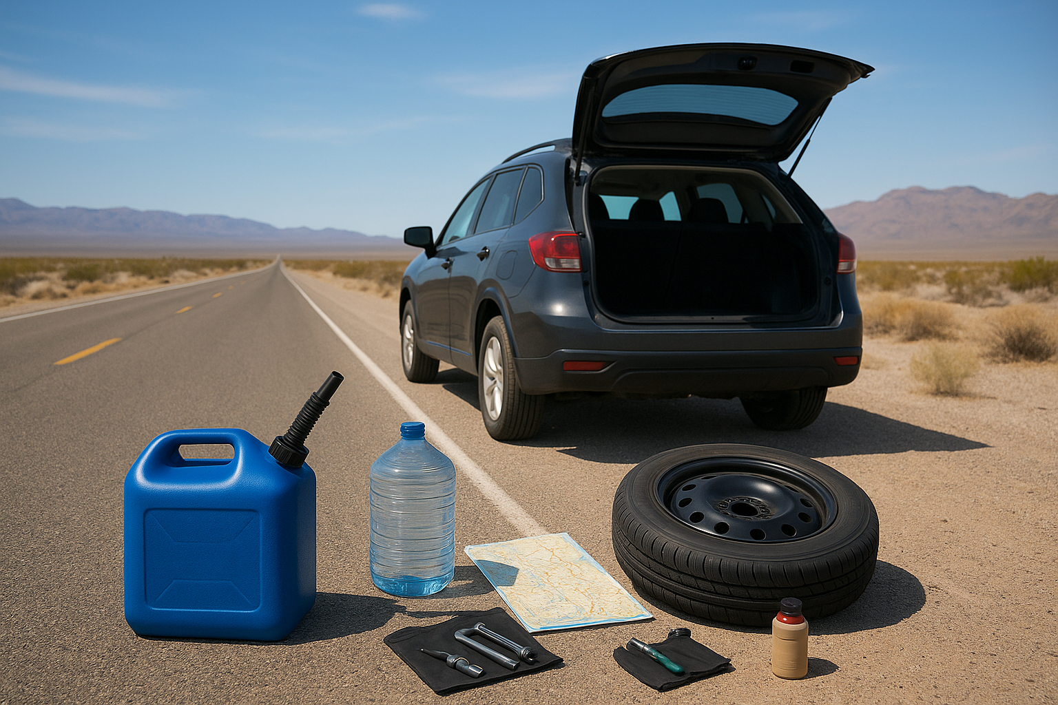
- Full tank of gas, topped off again in Pahrump if you’re taking the western loop
- At least one gallon of water per person, more in summer months
- A paper map or downloaded offline map, since cell service disappears for long stretches inside the park
- A spare tire and basic tools, since tow trucks in this area can take hours to arrive
- Sunscreen and a hat, even for short walks from the parking lot to an overlook
Most of these sound like overkill until you’re the person standing on the shoulder of Highway 190 with no bars on your phone. The National Park Service posts current road conditions and closures on its Death Valley website, and it’s worth a five-minute check the morning you leave, especially during flash flood season from July through September when sections of road can wash out with little warning. Checking ahead costs you nothing and can save you from turning around 40 miles into the trip.
Day trip or overnight stay: which makes sense for you
Deciding between a day trip and an overnight stay comes down to how many sites you want to see and how much heat you’re willing to tolerate, and it helps to see how to plan a Death Valley day trip out of Las Vegas before you commit. Given that the Las Vegas to Death Valley distance runs roughly 120 to 140 miles depending on your entry point, a single day gives you enough time to hit two or three major overlooks, but not the full park. If your list includes Zabriskie Point, Badwater Basin, and Artist’s Palette, you can realistically fit those into one long day. Add Ubehebe Crater or the Racetrack Playa to that list, and you’re pushing past what daylight and comfort allow without staying the night.
Budget-conscious travelers often default to the day trip because it skips lodging costs entirely, and that’s a fair trade-off if your goals are modest. A single day works well for visitors who mainly want the classic photo stops near Furnace Creek and are comfortable with five to six hours of driving sandwiched around two or three hours of actual sightseeing. It also suits anyone traveling with kids or older relatives who don’t want to pack for two locations in one trip.
A day trip covers the highlights. An overnight stay lets you actually experience the park instead of racing through it.
When an overnight stay pays off
Staying inside or near the park changes the entire rhythm of the trip. Instead of driving in the heat of midday, you catch sunrise at Zabriskie Point and sunset at Dante’s View, both of which look completely different depending on the light. Furnace Creek has lodging options ranging from campgrounds to higher-end resorts, and Stovepipe Wells offers a simpler, cheaper alternative closer to the dunes. Overnighting also removes the pressure of a hard deadline to get back on the road, which matters more than people expect once the afternoon heat sets in.
Options worth comparing before you book:
- Furnace Creek Ranch or Inn, central location near the visitor center and most major overlooks
- Stovepipe Wells Village, closer to Mesquite Flat Sand Dunes, generally lower rates
- Panamint Springs, on the western edge, quieter but farther from Furnace Creek’s main attractions
- Pahrump hotels, a middle-ground option if you want a shorter drive back to Las Vegas the next day
Matching the choice to your trip style
Running through a quick comparison usually clarifies the decision faster than agonizing over it.
| Factor | Day Trip | Overnight Stay |
|---|---|---|
| Total driving time | 5-6 hours round trip | Split across two days |
| Sites you can realistically cover | 2-3 major overlooks | 4-6 sites, including sunrise/sunset spots |
| Heat exposure | Concentrated in midday | Spread out, avoidable |
| Cost | Lower, no lodging | Higher, includes lodging |
| Best suited for | First-time visitors, tight schedules | Photographers, repeat visitors, summer travel |
Summer travelers, in particular, benefit from staying overnight since it lets you avoid driving during the hottest hours entirely. Winter visitors, on the other hand, often find a single day plenty, since the cooler temperatures stretch your comfortable sightseeing window well into the afternoon without the same urgency to retreat indoors.
Best time of year to make the drive
Timing changes everything about this trip, arguably more than the mileage itself. Understanding how far Death Valley is from Las Vegas matters less than knowing what the desert will feel like when you get there. The same 120-mile drive that’s a pleasant morning outing in February becomes a genuine safety concern in July, when road surfaces radiate heat and your car’s air conditioning works overtime just keeping the cabin livable. Picking the best time to visit Death Valley doesn’t shorten the drive, but it dramatically changes how much of the park you can comfortably enjoy once you arrive.
Winter, from November through February, gives you the widest comfort margin. Daytime highs at Furnace Creek typically sit in the 65 to 75 degree range, cool enough to hike Golden Canyon at noon without rationing your water every ten minutes. Nights can drop close to freezing, so pack layers if you’re staying over, but the daylight hours are forgiving in a way summer never is.
Winter gives you all day to explore. Summer gives you a window before sunrise and after sunset, and nothing in between.
Spring, running March through May, brings the wildflower blooms that draw photographers from across the country, along with warming temperatures that are still manageable through most of the day. Shoulder-season crowds pick up here, especially during a strong bloom year, so book lodging early if you’re planning an overnight stay.
Why summer changes your entire plan
Summer is where the math gets serious. Furnace Creek regularly tops 115 degrees Fahrenheit from June through August, and the National Park Service has documented some of the highest air temperatures ever recorded on the planet at this location. Pavement can reach temperatures hot enough to cause burns within seconds, which rules out casual walks to viewpoints during midday. Visitors who make the drive in summer typically shift their entire schedule around the heat rather than around convenience.
Adjusting your schedule by season
Rather than guessing at what a seasonal visit looks like, here’s how the practical plan shifts throughout the year:
| Season | Typical Daytime Temp | Best Hours to Explore | Notes |
|---|---|---|---|
| Winter (Nov-Feb) | 65-75°F | All day | Cool nights, widest comfort window |
| Spring (Mar-May) | 80-95°F | Morning through early evening | Wildflower blooms, busier crowds |
| Summer (Jun-Aug) | 110-120°F+ | Sunrise and after 6 PM only | Extreme heat risk, limited midday activity |
| Fall (Sep-Oct) | 85-100°F | Morning and late afternoon | Cooling trend, fewer visitors |
Fall offers a reasonable middle ground, with temperatures cooling gradually through September and October and crowds thinning out after the summer rush. Choosing your travel month with this table in mind saves you from arriving underprepared, and it’s worth checking current conditions on the National Park Service’s Death Valley page before you finalize plans, since heat advisories and road closures can shift year to year.
What to see along the way and inside the park
The drive itself isn’t just dead time between Las Vegas and Death Valley. Pahrump Valley offers a handful of small wineries if you want a break halfway through, and the open stretches past Amargosa Valley give you your first real look at the kind of stark, empty desert that makes Death Valley famous. Keep your eyes open around Ash Meadows National Wildlife Refuge, just off the route, where spring-fed pools support fish species found nowhere else on earth. It’s a short detour, but it’s the kind of stop most drivers blow past without knowing it’s there.
Highlights near Furnace Creek
Once you cross into the park, the Death Valley National Park highlights cluster fairly close to Furnace Creek, which makes it the natural first stop regardless of which route you took in. Here’s what draws the most visitors:
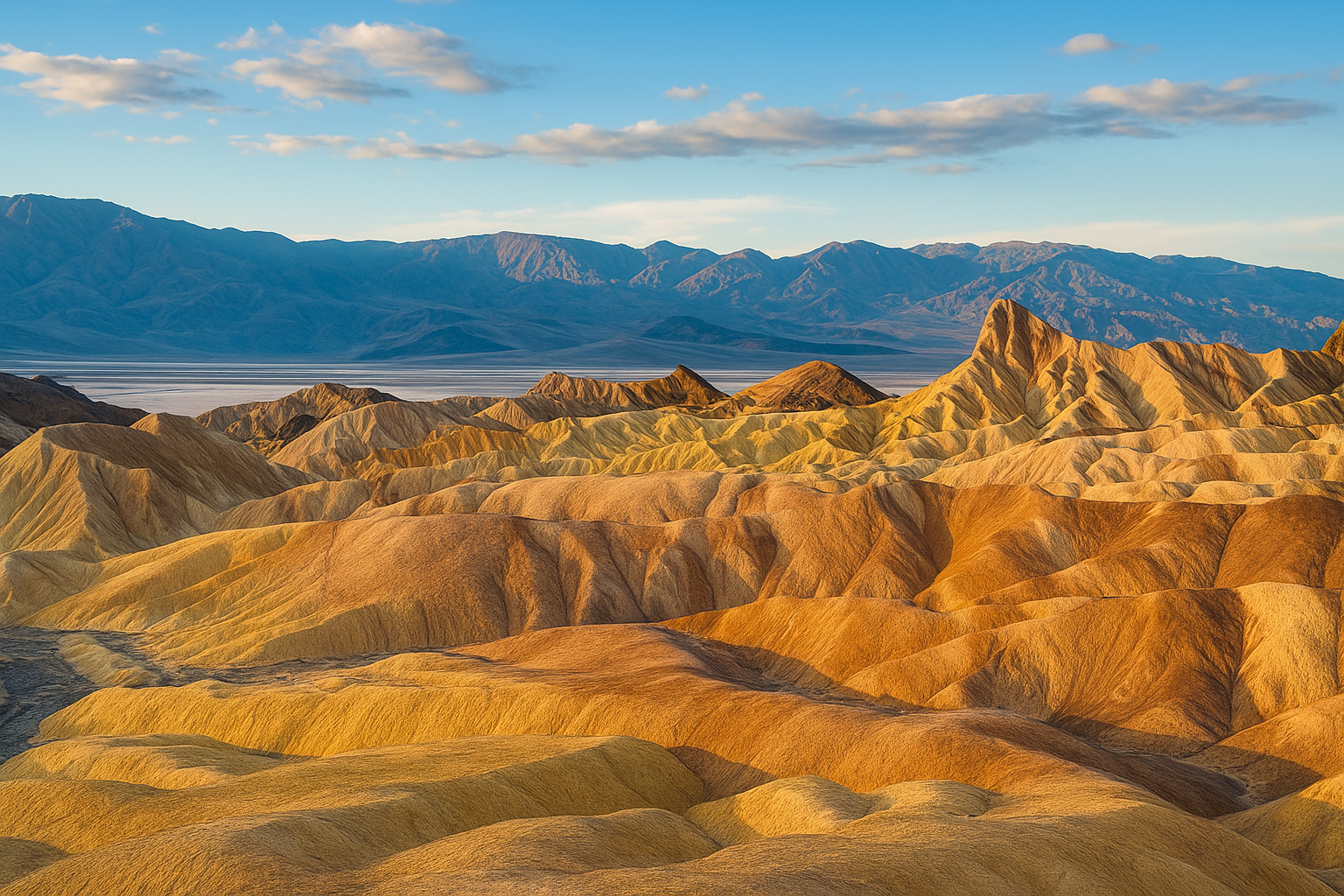
- Zabriskie Point, a short walk from the parking lot to one of the most photographed badland views in the country, best at sunrise
- Badwater Basin, the lowest point in North America at 282 feet below sea level, with a salt flat boardwalk you can walk in under 30 minutes
- Artist’s Palette, a nine-mile scenic drive through mineral-streaked hills that shift color through the afternoon
- Golden Canyon, a moderate 3-mile round-trip hike through narrow canyon walls, best done before 10 AM in warmer months
- Furnace Creek Visitor Center, worth 20 minutes for exhibits on the park’s geology and history, plus the only reliable restrooms and air conditioning for miles
Furnace Creek gets you the classics. Everything past it costs you extra hours you may not have.
Farther into the park
Getting to the sites north and west of Furnace Creek takes real commitment, since distances inside Death Valley are deceptively large. Mesquite Flat Sand Dunes, near Stovepipe Wells, rise up to 100 feet and are easiest to walk in early morning light before the sand heats up. Ubehebe Crater, a half-mile-wide volcanic crater roughly an hour past Furnace Creek, rewards the drive with a view unlike anything else in the park. Racetrack Playa, home to the famous "sailing stones" that mysteriously slide across the dry lakebed, requires a high-clearance vehicle and a full day round trip, so it’s rarely realistic on a single day trip from Las Vegas.
If your schedule only allows one loop through the park, prioritize Zabriskie Point, Badwater Basin, and Artist’s Palette. Those three sit within a 20-minute drive of each other near Furnace Creek and give you the range of landscapes Death Valley is known for, from below-sea-level salt flats to eroded, rainbow-colored hills, without adding hours of extra driving. Save Ubehebe Crater and Racetrack Playa for a return trip or an overnight stay, when you’re not racing sunset back to the Strip.
A sample one-day itinerary from Las Vegas
Seeing this laid out as an actual schedule makes the abstract math from earlier sections much easier to plan around. This sample day trip itinerary for Death Valley assumes a winter or fall departure, since summer heat forces a completely different, much earlier schedule. Adjust the wake-up time forward by two or three hours if you’re making this drive in June, July, or August.
Morning: departure and Zabriskie Point
Leaving Las Vegas by 6:00 AM gets you to Zabriskie Point around 8:15 AM, right as the morning light hits the badlands and before tour buses arrive in force. Grabbing coffee and gas in Pahrump on the way out saves you from hunting for either once you’re inside the park, where prices climb and options thin out fast. Spending 30 to 40 minutes here is enough to walk the short overlook trail, take photos, and move on before the parking lot fills up.

An early departure buys you the best light of the day and the emptiest parking lots.
Midday: Badwater Basin and Artist’s Palette
Driving south from Zabriskie Point puts you at Badwater Basin by roughly 9:15 AM, still cool enough for the 15 to 20 minute walk out onto the salt flats. Artist’s Palette comes next, about a 20-minute drive north, where the nine-mile scenic loop through mineral-streaked hills works best between 10:00 and 11:00 AM before the sun washes out the color contrast. Lunch at Furnace Creek around noon breaks up the day and gets you out of the worst midday heat for an hour.
Afternoon: one more stop or the drive back
Here’s roughly how the day breaks down if you’re keeping to this pace:
- 6:00 AM – Depart Las Vegas
- 8:15 AM – Arrive Zabriskie Point
- 9:15 AM – Badwater Basin
- 10:15 AM – Artist’s Palette
- 12:00 PM – Lunch at Furnace Creek
- 1:00 PM – Optional: Golden Canyon hike or Mesquite Flat Sand Dunes
- 3:00 PM – Depart for Las Vegas
- 5:15 PM – Arrive back on the Strip
Fitting in a fourth stop, usually Golden Canyon or the sand dunes near Stovepipe Wells, depends entirely on how quickly you moved through the morning and how much heat you’re willing to tolerate in the early afternoon. Leaving Furnace Creek by 3:00 PM keeps you off Highway 190 after dark, which matters since the road has no lighting and occasional wildlife crossings.
Running this itinerary solo means watching the clock constantly, since every extra 20 minutes at one stop cuts into the next. Travelers who’d rather not manage that timing themselves often book a Las Vegas day tour to Death Valley instead, where a guide handles the pacing and knows exactly when to leave each stop to keep the whole day on schedule.
Tips for a safe and smooth desert drive
Driving through open desert isn’t like a highway commute, and treating it that way is how people end up stranded. Whether you’re covering the 120 miles from Las Vegas to Death Valley on Highway 160 or the longer loop through Amargosa Valley, the same rules apply: plan for isolation, plan for heat, and don’t assume your phone will bail you out if something goes wrong. Cell coverage disappears for long stretches once you’re past Pahrump, and AAA response times inside the park can stretch past two hours during peak season.
Before you leave Las Vegas
Getting the prep work done before you hit the road matters more than any gadget you pack. Rental cars especially are rarely stocked for a genuine desert crossing, so build in a few extra minutes at the start of your trip:
- Check your tire pressure and spare, since heat expands air and a slow leak becomes a flat fast on 100-degree pavement
- Tell someone your route and return time, particularly if you’re heading past Furnace Creek toward Ubehebe Crater or Racetrack Playa
- Download offline maps, since Google Maps and GPS apps stop pulling live data once signal drops
- Pack more water than feels necessary, a gallon per person minimum, more if you’re hiking
Treat every desert drive like there’s no cell service and no gas station for the next hundred miles, because there usually isn’t.
On the road
Watching your gauges becomes a habit fast once you’ve made this drive a few times. Keep your gas tank above half full at all times inside the park, since the two stations at Furnace Creek and Stovepipe Wells charge a steep premium and sometimes run low during busy weekends. Slowing down for wildlife crossings matters too, particularly around dawn and dusk when bighorn sheep and coyotes are more active near the roadside. Overheating engines are also a real risk in summer; if your temperature gauge climbs, pull over, turn off the AC, and let the engine idle rather than pushing through to the next stop.
If something goes wrong
Running into trouble on a road this remote calls for patience over panic. Staying with your vehicle is almost always the safer move if you break down, since it’s easier for rangers or other drivers to spot a car than a person walking along the shoulder. Flag down any passing vehicle if you need help, since traffic is sparse but rarely nonexistent, even on the quieter stretches of Highway 190. Keep a paper copy of the National Park Service’s Death Valley road conditions page or a printed map in the glovebox, since a dead phone battery shouldn’t mean you’re navigating blind.
Following through on these basics turns a demanding drive into a manageable one. None of it requires special equipment or expertise, just the discipline to prep before you leave rather than improvise once you’re already deep into the badlands with no signal bars in sight.
Guided tours vs driving yourself
Deciding between a rental car and a guided Death Valley tour comes down to what you actually want out of the day: control over the schedule, or someone else absorbing the risk and the navigation. Renting a car gives you flexibility to linger at Zabriskie Point an extra 20 minutes or skip Artist’s Palette entirely if you’re running behind. That freedom comes with real tradeoffs, though, since you’re also the one responsible for gas, water, heat safety, and getting back to the Strip before dark on roads with no lighting.
Joining a guided tour from Las Vegas flips that equation. A driver who’s made this run dozens of times knows exactly when Zabriskie Point empties out, which viewpoints are worth 10 minutes versus 40, and how to time lunch so you’re not sitting in a parking lot during the hottest part of the afternoon. Narration adds context you’d otherwise miss entirely, since most first-time visitors have no idea Badwater Basin sits 282 feet below sea level or why the hills at Artist’s Palette turn different colors depending on the mineral content, until someone explains it.
A guide doesn’t just drive you there. They know which twenty minutes at each stop are worth having.
Weighing the two options
| Factor | Driving Yourself | Guided Tour |
|---|---|---|
| Schedule control | Full flexibility | Fixed itinerary, expertly paced |
| Heat and safety risk | On you entirely | Handled by an experienced driver |
| Cost | Lower, gas and rental only | Higher, but includes everything |
| Local context and history | Self-researched | Delivered by a trained guide |
| Vehicle condition and prep | Your responsibility | Not your problem |
| Best for | Independent travelers, repeat visitors | First-timers, groups, hands-off travelers |
Cost is the obvious argument for driving yourself, and it’s a fair one if you’re comfortable planning routes, checking road conditions, and packing for a genuine desert crossing. But that savings shrinks fast once you factor in a rental car, gas for roughly 250 to 280 miles round trip, and the hours spent double checking National Park Service alerts the morning of your trip.
First-timers, in particular, tend to underestimate how much planning this drive actually takes. Numbers on a map don’t tell you that Highway 190 has zero cell service for 40 miles, or that Furnace Creek’s single gas station sometimes runs low on a busy Saturday. Groups traveling with kids or older relatives also benefit from having someone else handle the driving, since a long desert crossing in a rental car isn’t everyone’s idea of a relaxing vacation stop.
Most travelers land somewhere in between: they’d rather see Death Valley without becoming an amateur logistics coordinator first. If that’s you, an Another Side Tours Death Valley excursion covers the driving, timing, and storytelling in one package, leaving you free to actually look at the landscape instead of the gas gauge.
Getting from the Strip to the badlands
The distance itself is simple: roughly 120 miles and two hours, give or take, depending on which corner of the park you’re chasing. The planning around that distance is where trips actually succeed or fall apart. Get your timing right, respect the heat, and pack for genuine isolation, and you’ll come home with photos of Zabriskie Point at sunrise instead of a story about running low on gas near Amargosa Valley.
Whether you drive yourself or hand the wheel to someone else, the goal is the same: seeing the salt flats, the badlands, and the canyons without spending the whole day worrying about logistics. If you’d rather skip the route planning and let a local guide handle the pacing, the water, and the storytelling, reserve a private desert day trip with your own guide built around exactly this kind of route.